
Headline:
Special Weather Statement issued May 30 at 6:39AM EDT by NWS Louisville KY
Event:
Special Weather Statement
Urgency:
Expected
Effective:
May 30, 2025 - 3:39am
Expires:
May 30, 2025 - 4:15am
Description:
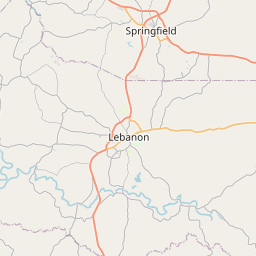
At 638 AM EDT, Doppler radar was tracking a strong thunderstorm near
Lebanon, moving east at 35 mph. This storm has a history of
persistent rotation.
HAZARD...Wind gusts up to 40 mph.
SOURCE...Radar indicated.
IMPACT...Gusty winds could knock down tree limbs and blow around
unsecured objects.
Locations impacted include...
Lebanon, Perryville, Brumfield, Rineltown, Dixville, Poplar Corner,
Stewart, Jenkinsville, Aliceton, and Mitchellsburg.
Instruction:
If outdoors, consider seeking shelter inside a building.
This storm may intensify, so be certain to monitor local radio
stations and available television stations for additional information
and possible warnings from the National Weather Service.
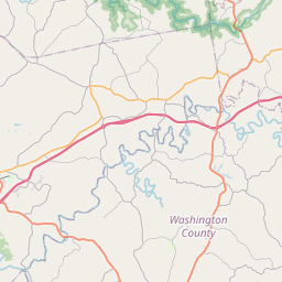
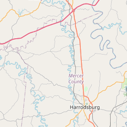
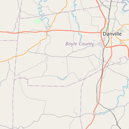
Area Description:
Washington; Mercer; Marion; Boyle
Forcast Office:
NWS Louisville KY
Leaflet | OSM Mapnik