
Headline:
Tornado Warning issued May 30 at 5:50PM EDT until May 30 at 6:30PM EDT by NWS Baltimore MD/Washington DC
Event:
Tornado Warning
Urgency:
Immediate
Effective:
May 30, 2025 - 2:50pm
Expires:
May 30, 2025 - 3:30pm
Description:
TORLWX
The National Weather Service in Sterling Virginia has issued a
* Tornado Warning for...
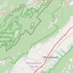
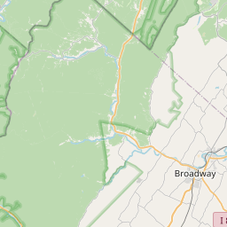
Southern Shenandoah County in northwestern Virginia...
Central Rockingham County in western Virginia...
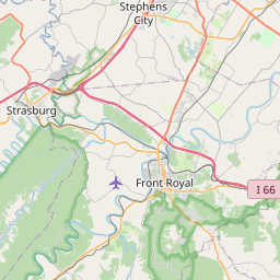
Southwestern Warren County in northwestern Virginia...
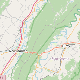
Northern Page County in northwestern Virginia...
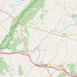
West central Rappahannock County in northwestern Virginia...
* Until 630 PM EDT.
* At 549 PM EDT, a severe thunderstorm capable of producing a tornado
was located near Mount Jackson, or 16 miles southwest of Woodstock,
moving east at 40 mph.
HAZARD...Tornado.
SOURCE...Radar indicated rotation.
IMPACT...For those in the direct path of a tornado touchdown,
flying debris will be dangerous to those caught without
shelter. Damage to roofs, siding, and windows may occur.
Mobile homes may be damaged or destroyed. Tree damage is
likely.
* This dangerous storm will be near...
Luray and Mount Jackson around 555 PM EDT.
Sperryville around 615 PM EDT.
Other locations impacted by this tornadic thunderstorm include
Kimball, Kings Crossing, Compton, Shenandoah Caverns, Leaksville,
Hamburg, Fourway, Quicksburg, Fairview, and Bentonville.
Instruction:
TAKE COVER NOW! Move to a basement or an interior room on the lowest
floor of a sturdy building. Avoid windows. If you are outdoors, in a
mobile home, or in a vehicle, move to the closest substantial shelter
and protect yourself from flying debris.
Area Description:
Page, VA; Rappahannock, VA; Rockingham, VA; Shenandoah, VA; Warren, VA
Forcast Office:
NWS Baltimore MD/Washington DC


Leaflet | OSM Mapnik